In fields such as ecological environment monitoring, forestry resource surveys, desertification control, and modern agricultural research, vegetation coverage and canopy closure are critical indicators for assessing ecosystem health, crop growth status, and surface protection capabilities. With the rapid advancement of digital image processing technology, traditional methods—such as visual estimation and plot sampling—are increasingly being replaced by high-precision, intelligent instruments due to their inherent subjectivity and labor-intensive nature. Given the diverse monitoring requirements across different scenarios, users often face a dilemma when selecting a brand or model: how exactly should one choose a vegetation coverage meter?
As a leading domestic enterprise specializing in the R&D of instruments for ecological environments and agricultural information technology, Laiyin Technology has leveraged its extensive technical expertise to launch a series of vegetation coverage meters tailored to various application scenarios. Among these, the IN-GD10 and IN-GD20 stand out as the two most representative core models. This article provides an in-depth analysis of the technical features, key advantages, and applicable scenarios of these devices, helping you make the most informed selection based on your budget and specific research or monitoring needs.
I. Clarifying Needs: Key Factors in Selecting a Vegetation Coverage Meter
When selecting a vegetation coverage meter, users must first identify their primary application scenario. Generally, measurement needs fall into two categories: the first involves mobile, multi-point, temporary sampling surveys in the field, requiring devices that are highly portable, flexible to operate, and adaptable to complex terrain; the second involves long-term, continuous, unattended fixed-plot monitoring, requiring devices with robust environmental durability, reliable power supply systems, and automated data acquisition and transmission capabilities.
Beyond the application scenario, the accuracy of image segmentation algorithms, the imaging quality of the hardware camera, and the software's data processing and export capabilities are all crucial benchmarks for evaluating the strength of a vegetation coverage meter brand. Addressing these two core needs, Laiyin Technology developed the portable IN-GD10 and the fixed, long-term monitoring IN-GD20, creating a perfectly complementary product lineup. II. The Preferred Choice for Portable Field Surveys: Laiyin Technology IN-GD10 Vegetation Coverage Analysis System
If you are engaged in forestry surveys, grassland degradation studies, or field research projects that require frequent relocation of measurement sites, the Laiyin Technology IN-GD10 Vegetation Coverage Analysis System is your ideal choice. Priced at 23,800 RMB, this device offers exceptional cost-performance and practical value.
1. Hardware Configuration and Excellent Field Portability
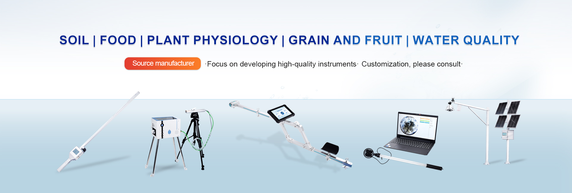
The IN-GD10 system is equipped with high-specification professional imaging hardware featuring a resolution of at least 24.2 megapixels and an 18–45mm wide-angle focal length range. It supports automatic optical focusing, auto-exposure, and automatic flash compensation. This ensures the capture of clear, authentic, and high-resolution vegetation images under the variable lighting conditions often encountered in the field. The entire system is mounted on a lightweight, portable tripod with an adjustable bracket; it is easy to set up, lightweight, and highly mobile, allowing it to handle complex terrains such as mountains, hills, and grasslands with ease. The imaging unit features built-in high-capacity storage (at least 128GB) and supports the processing of ultra-large image files (50MB or larger), ensuring the integrity of data collection.
2. Powerful Software Algorithms and Offline Capability
The IN-GD10 is compatible with Android mobile devices (running Android 6.0 or higher) and communicates with the imaging unit via a wireless connection with a range of up to 10 meters. Crucially, the imaging unit features a built-in hotspot function, enabling stable connectivity in extreme outdoor environments where no network signal exists—effectively solving connectivity challenges in remote areas or deep forests. The software includes a wide range of image segmentation modes, such as HSV color space segmentation, RGB segmentation, multi-color selection segmentation, and specialized soil-vegetation model segmentation. The system supports both automatic and manual threshold adjustment, intelligently distinguishing between vegetation and non-vegetation areas. It offers a measurement range of 0% to 100% with a resolution of 0.01% and an overall measurement accuracy of at least 90%. 3. Comprehensive Data Management and Cloud Collaboration
The system’s image interpretation software offers a robust suite of features. It supports not only the calculation of coverage or canopy closure from single images but also automated batch processing, significantly boosting the efficiency of post-processing analysis. Both source images and output files contain geospatial data (latitude and longitude). The software includes tools for cropping, panning, rotating, and centering images, and can generate both binary (black-and-white) and color-coded comparison images, achieving a calculation accuracy of at least 95%. Upon completion of the analysis, the system saves the results, tolerance values, color parameters, and both original and binary images, allowing for the one-click export of a data folder containing Excel spreadsheets. In environments with network connectivity, users can upload analyzed data to the cloud via mobile devices, ensuring long-term data preservation and enabling access from multiple devices at any time.
III. A Powerful Tool for Fixed, Long-Term Field Monitoring: Laiyin Technology IN-GD20 Vegetation Coverage Analysis System
For projects requiring fixed observation stations to track vegetation growth, canopy closure changes, or long-term desertification trends in specific areas, manual periodic measurements are not only costly but also fail to provide the high-frequency, round-the-clock recording needed. To address this, Laiyin Technology developed the IN-GD20 Vegetation Coverage Analysis System. Priced at 38,000 RMB, this high-end environmental monitoring solution integrates fully automated data acquisition, solar power supply for field use, and wireless data transmission.
1. Industrial-Grade Field Hardware and Versatile Zoom Lens
The IN-GD20 utilizes camera equipment specifically designed for extreme field environments. Although it features an 8-megapixel sensor, it is equipped with a powerful 25x motorized optical zoom lens covering a wide focal length range of 2mm to 125mm. Even more impressive is the lens's ability to rotate 360 degrees horizontally and tilt vertically from -15 to 90 degrees. Paired with an integrated analysis unit (featuring a 10-inch color touchscreen), the system allows users to control the lens's direction and focal length either on-site or remotely. The entire system is equipped with a robust mounting structure (standard configuration includes a 3-meter vertical pole and a 2.5-meter horizontal arm; lengths can be customized). It operates across a wide temperature range of -40°C to 55°C and a humidity range of 0% to 100% RH, featuring excellent water and dust resistance.
2. Fully Automated, Unattended Operation and Intelligent Power Supply
Designed for long-term monitoring, the IN-GD20 features advanced automated data acquisition and transmission capabilities. Using built-in GPS coordinates, it intelligently detects local sunrise and sunset times to automatically capture and analyze images during the day while pausing at night to conserve energy. Users can customize acquisition and transmission intervals, ranging from a minimum of 30 minutes to a maximum of 72 hours. To ensure continuous operation in off-grid field environments, the unit is equipped with a powerful solar power system—comprising a 200W solar panel and a 130Ah gel battery—guaranteeing reliable performance even during prolonged periods of overcast or rainy weather. It also supports 220V AC power input, providing a dual power supply safeguard.
3. 4G IoT Transmission and Multi-Layer Security Protection
Regarding data storage and transmission, the IN-GD20 offers 20GB of local storage capacity, with support for exporting data via USB flash drive. A built-in 4G wireless module automatically uploads captured images and analysis data to a cloud-based agricultural data center. Users can log in to the cloud platform via a dedicated account to view real-time data remotely, download original images, and export historical records in spreadsheet format. To mitigate risks such as data leakage or accidental operation in the field, the system includes an optional administrator password feature; once enabled, a password is required for all configuration changes and data access, effectively preventing unauthorized setting modifications and ensuring data security. Additionally, a mobile app is available, allowing administrators to perform remote monitoring anytime, anywhere.